
City landmarks
Roughly 1,500 custom buildings depict central Washington, its bridges, harbours and stadiums. The scenery reaches College Park and the Virginia suburbs.
Washington, DC, USA Map
X-Plane 11
Follow the Potomac through Washington, D.C., from the monuments on the National Mall to the airports around the capital.
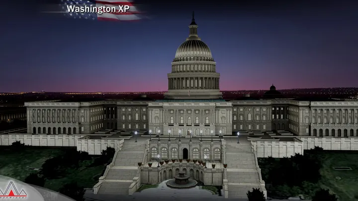
Roughly 1,500 custom buildings depict central Washington, its bridges, harbours and stadiums. The scenery reaches College Park and the Virginia suburbs.
The riverside airport has terminal interiors, detailed ground markings and parked aircraft.
Joint Base Andrews, College Park, Potomac Airfield and Washington Executive have lighter models with custom buildings and ground layouts.
Fixed jetways and native X-Plane reflections depict the apron at Reagan National.
Heliports include the White House, Pentagon, Joint Base Anacostia–Bolling and Sibley Memorial Hospital.
City scenery extends from McLean to Newington, Cheltenham and College Park, with night textures across the built-up area.


Designed for X-Plane 11.
Remove earlier or overlapping scenery for the same location before installing. On Windows, run the supplied installer. On macOS or Linux, follow the manual installation guide included with the download.
Customer support has ended for this edition. No further updates will be released.
Washington, D.C., occupies the eastern side of the Potomac opposite Arlington, Virginia. The National Mall runs from the Capitol towards the Washington Monument and Lincoln Memorial. Beyond it, bridges connect the government district and its museums with the Virginia shoreline. The relatively low central skyline lets the shape of the street plan stand out from the air.
Pierre Charles L’Enfant laid out the federal capital in 1791. Broad diagonal avenues cross a grid of streets and bring important sites into long lines of sight. The river bends past Georgetown, the memorials and the airport at Arlington. From that waterfront the city’s ceremonial centre, its neighbourhoods and the landscape on the opposite bank are readily distinguishable.
Aviation around the capital has an equally long history. At College Park in Maryland, Wilbur Wright trained US Army pilots in 1909. National Airport opened on the Potomac in 1941 and became the city’s close-in airline gateway. College Park, Potomac Airfield and the larger airfield at Andrews show how many different kinds of flying developed within reach of the capital.
Included airfields · KDCA, KADW, KCGS, KVKX, W32


