
Metropolitan Warsaw
About 5,200 square kilometres of seasonal and night imagery cover the capital, with custom landmarks, bridges and stadiums.
Warsaw, Poland Map
Microsoft Flight Simulator 2004
Follow the Vistula through central Warsaw, passing the skyline and river bridges on the way to airfields around the capital.
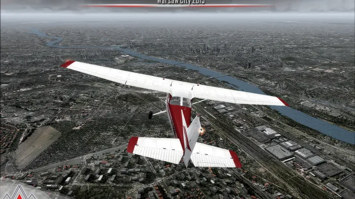
About 5,200 square kilometres of seasonal and night imagery cover the capital, with custom landmarks, bridges and stadiums.
The region includes Modlin, Babice, smaller landing grounds and numerous helipads. The edition works with Warsaw Chopin Airport 2015.
Custom charts cover Babice and Modlin. Modlin also supports Aerosoft Airport Enhancement Services.


The free FS2004 collection includes this edition and five other Polish scenery releases. See what is included.
Designed for Microsoft Flight Simulator 2004 (FS9). Supports mesh, landclass and vector add-ons and works with Warsaw Chopin Airport 2015.
Extract the desired scenery installers from the free collection. Remove previous versions and duplicate airport layout files (AFCADs), then run the installer. It adds the scenery to the FS2004 Scenery Library. Run it again to change optional features.
Customer support has ended for this edition. No further updates will be released.
The Vistula divides Warsaw between the historic centre on its higher western bank and the district of Praga to the east. The Royal Castle and the roofs of the Old Town overlook the river. Across the water, the National Stadium rises above the low-lying shore. Farther west, the Palace of Culture and Science and the office towers mark a separate centre of gravity in the skyline.
Much of the Old Town was destroyed during the Second World War. Its reconstruction drew on architectural records, historic views and surviving fragments of the original buildings. Seen from the river, the closely spaced roofs and church towers of the rebuilt district occupy a very different scale from the broad avenues and taller buildings of central Warsaw.
Aviation also left several distinct sites around the city. Early flying took place at Pole Mokotowskie, and passenger traffic later moved to Okęcie. Babice developed on the northwestern side of Warsaw and became an important general aviation field. Beyond the built-up area, smaller airfields and grass strips give the surrounding Mazovian countryside a character of its own.
Included airfields · EPMO, EPBC, EPNC, EPSJ, EPGO, EPKU, Ręczaje, Kroczewo, Trębki Nowe, Wincentów 1, EPW8, EPW4


