
Seattle skyline
More than 2,000 custom objects depict downtown, its bridges, stadiums, marinas and port facilities.
Seattle, Washington, USA Map
Microsoft Flight Simulator 2020 & 2024
Follow Seattle’s waterfront past the downtown towers to its seaplane docks and helicopter landing sites.
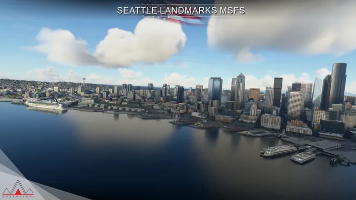
More than 2,000 custom objects depict downtown, its bridges, stadiums, marinas and port facilities.
Two seaplane bases (W55 and S60) and five heliports offer landing sites across the city.
Custom terrain, trains, ships, night lighting and physically based materials integrate with the simulator’s city photogrammetry.


Compatible with Microsoft Flight Simulator 2020 and 2024, and with Drzewiecki Design, Orbx and Asobo scenery.
Use the installer or scenery manager supplied by your retailer. If the installer offers scenery options, run it again to change them.
Seattle occupies a strip of hilly land between Puget Sound and Lake Washington. Downtown rises above Elliott Bay, where ferries cross in front of the city piers. To the south, container cranes, rail yards and the Duwamish River mark the working port. To the north, the Space Needle fixes the position of Seattle Center, built for the 1962 World’s Fair.
The city’s waterways form a connected system. From Lake Washington, the ship canal passes through Lake Union and the Ballard Locks before reaching the salt water of Puget Sound. The canal officially opened in 1917. Bridges cross its narrower sections, while marinas, boatyards and houseboats line parts of the shore.
Seaplanes give that geography an aviation dimension. Lake Union brings floatplanes close to the city centre, and Kenmore’s base sits at the northern end of Lake Washington. A flight between the two reveals how hills and water divide otherwise neighbouring districts. On a clear day the Cascade Range and Mount Rainier also give the city’s skyline a much larger backdrop.
Included airfields · W55, S60


