
Central Moscow
Around 1,000 custom objects include the city’s palaces, towers, bridges, railway stations, trains and ships.
Moscow, Russia Map
Microsoft Flight Simulator 2020 & 2024
Follow the Moskva River past the Kremlin, then fly on to the airports surrounding the Russian capital.
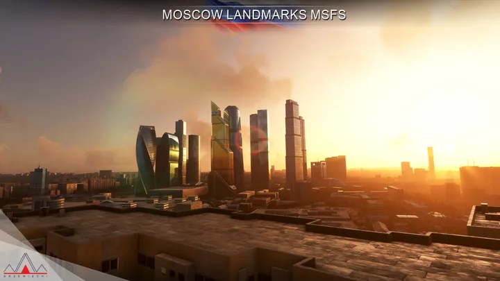
Around 1,000 custom objects include the city’s palaces, towers, bridges, railway stations, trains and ships.
Both airports have custom ground layouts, runway profiles, buildings and animated jetways.
Five further airports have modelled buildings, vehicles and parked aircraft. Around 30 heliports include rooftop landing sites.


Compatible with Microsoft Flight Simulator 2020 and 2024, and with Drzewiecki Design, Orbx and Asobo scenery.
Use the installer or scenery manager supplied by your retailer. If the installer offers scenery options, run it again to change them.
Moscow grew around a bend in the Moskva River, with the Kremlin on high ground above its northern bank and Red Square immediately outside the walls. Follow the river west on a map and the low historic centre gives way to the high-rise business district. Farther around the bends are stadiums, parks and the wooded slopes at Sparrow Hills.
The city spread in a succession of rings. The Boulevard Ring and Garden Ring trace former lines of fortification, while major roads radiate outward from the centre. Railway lines converge on separate terminal stations around the inner city. Together with the river crossings, these routes make the pattern of Moscow’s growth particularly clear from the air.
Its aviation geography extends well beyond those rings. Vnukovo lies southwest of the centre and Domodedovo is farther to the southeast. Smaller airfields and sites associated with flying clubs, industry and aircraft development occupy other parts of the metropolitan area. On a flight across Moscow, the outlying airfields, suburban districts and dense riverfront form three distinct parts of the same landscape.
Included airfields · UUWW, UUDD, UUBW, UUMO, UUBM, UUMU, UUMB


