
Midway airfield
High-resolution terrain reproduces the runway profiles across the airport’s compact site. The scenery fits alongside Chicago Landmarks MSFS.
KMDW · Chicago, Illinois Map
Microsoft Flight Simulator 2020 & 2024
Fly into Midway’s compact grid of intersecting runways, surrounded on all sides by Chicago’s southwest neighbourhoods.
High-resolution terrain reproduces the runway profiles across the airport’s compact site. The scenery fits alongside Chicago Landmarks MSFS.
All terminal buildings, most hangars and the control tower have modelled interiors.
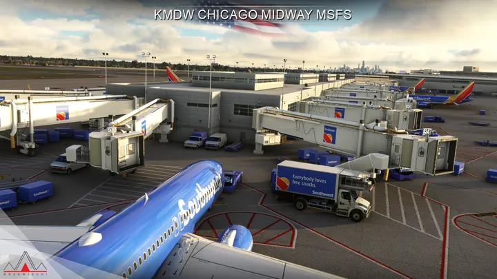
Custom jetways, parked aircraft, dynamic lighting and animations depict the gates. Cartayna Files provide GSX Pro compatibility.


Compatible with Microsoft Flight Simulator 2020 and 2024, and with Drzewiecki Design, Orbx and Asobo scenery.
Use the installer or scenery manager supplied by your retailer. If the installer offers scenery options, run it again to change them.
Chicago Midway International Airport (KMDW) fits into roughly one square mile on the southwest side of Chicago. From the air, the boundary is unusually easy to pick out. Residential blocks and straight city streets surround a square of pavement crossed by diagonal runways, with scarcely any open land between the airport fence and the first houses.
Chicago Municipal Airport was dedicated in 1927, when contract airmail helped establish the field. It became the city’s principal passenger airport during the era of piston airliners. In 1949 it was renamed Midway to commemorate the Battle of Midway. As longer-range jets entered airline service, O’Hare’s greater runway lengths drew much of Chicago’s traffic to the northwest side.
Midway developed a new role as a busy short- and medium-haul airport. Its terminal arrangement makes particularly good use of the limited site. The ticketing building stands on the opposite side of Cicero Avenue from the airfield, and an enclosed pedestrian bridge carries passengers over the street to the concourses. The city grid remains intact right up to the gates.


