
Runway profile
High-resolution terrain follows the runway’s elevation changes. Local landmarks help identify the airport on approach.
EPMO · Modlin, Poland Map
Microsoft Flight Simulator 2020 & 2024
Fly into Modlin near the meeting of the Vistula and Narew rivers, with Warsaw to the southeast.
High-resolution terrain follows the runway’s elevation changes. Local landmarks help identify the airport on approach.
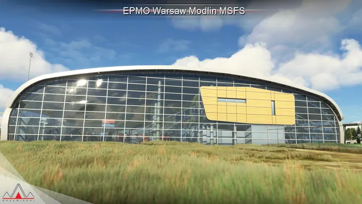
Modelled interiors extend from the passenger terminal and control tower into the hangars.
Dynamic lights, physically based materials and custom animations depict ground operations. Cartayna Files support GSX Pro.


Compatible with Microsoft Flight Simulator 2020 and 2024, and with Drzewiecki Design, Orbx and Asobo scenery.
Use the installer or scenery manager supplied by your retailer. If the installer offers scenery options, run it again to change them.
Warsaw Modlin Airport (EPMO) lies near Nowy Dwór Mazowiecki, about forty kilometres northwest of central Warsaw. Close to the airfield, the Narew joins the Vistula beside the extensive brick fortifications of Modlin Fortress. The rivers, their broad floodplains and the nearby town make this a very different setting from Warsaw Chopin Airport in the capital’s southwestern suburbs.
The site was earmarked for military aviation before the Second World War and brought into use during the war. It remained a military airfield for much of the following half-century. The long runway and dispersed buildings left by that period made it a candidate for conversion once military flying ended, although the runway, lighting and navigation equipment all needed substantial work.
A new terminal and apron opened for scheduled passenger flights in July 2012. Built alongside the existing airfield, the compact terminal became a base for low-cost services to Warsaw. The surrounding military-era grounds also explain the difference between this passenger-airport edition and Drzewiecki Design’s 2009 depiction of Modlin, which recorded the site before its conversion.


