
Balice airfield
The passenger airport includes its aprons, taxiways, stand markings and ground vehicles.
EPKK · Kraków, Poland Map
X-Plane 11
Approach Balice from the hills west of Kraków, with the historic city and its landmarks beyond the airport.
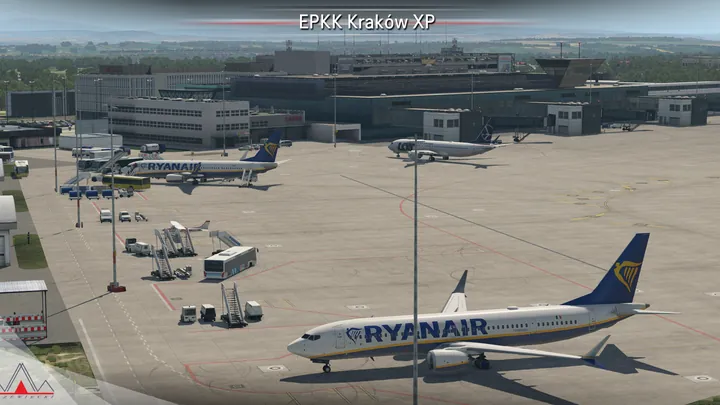
The passenger airport includes its aprons, taxiways, stand markings and ground vehicles.
The Polish Aviation Museum at Czyżyny and aerial imagery of Kraków extend the scenery east of Balice.
A sloping runway leads to terminal, tower and hangar interiors. SAM adds animated jetways, docking guidance and marshallers.


Designed for X-Plane 11.
Remove earlier or overlapping scenery for the same location before installing. On Windows, run the supplied installer. On macOS or Linux, follow the manual installation guide included with the download.
Customer support has ended for this edition. No further updates will be released.
Kraków John Paul II International Airport (EPKK) is at Balice, about eleven kilometres west of central Kraków. The civilian terminal and military facilities share one airfield. The surroundings change quickly on the way into the city, from wooded ridges and villages near Balice to the Vistula, Wawel Hill and the closely packed streets of the historic centre.
Kraków’s first major airfield was on the other side of the city at Rakowice–Czyżyny. Established as a military field in 1912, it later handled passenger services. As the city expanded around it, civil flying moved west to Balice in 1964. A surviving section of the old runway and the aircraft collections of the Polish Aviation Museum mark the earlier site.
Balice developed from a military installation into the principal passenger gateway to Lesser Poland. Successive terminals, larger aprons and the rail connection to Kraków changed the civilian side of the field. The continuing military presence accounts for the separate groups of hangars visible around a runway shared by passenger jets and transport aircraft.
Included airfields · EPKK, EPKC


